
12 August 2026
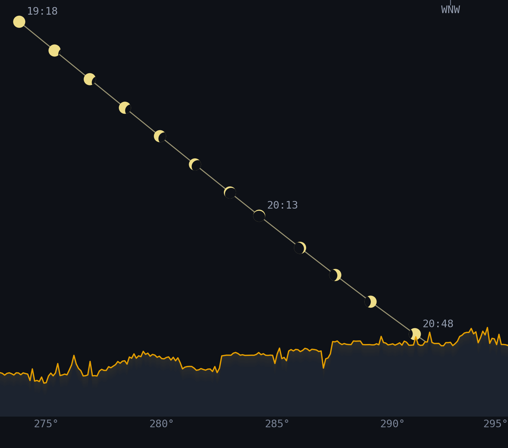
At maximum eclipse, the sun sits just 7.7 degrees above the horizon. I wanted to know if trees and buildings would block the view.
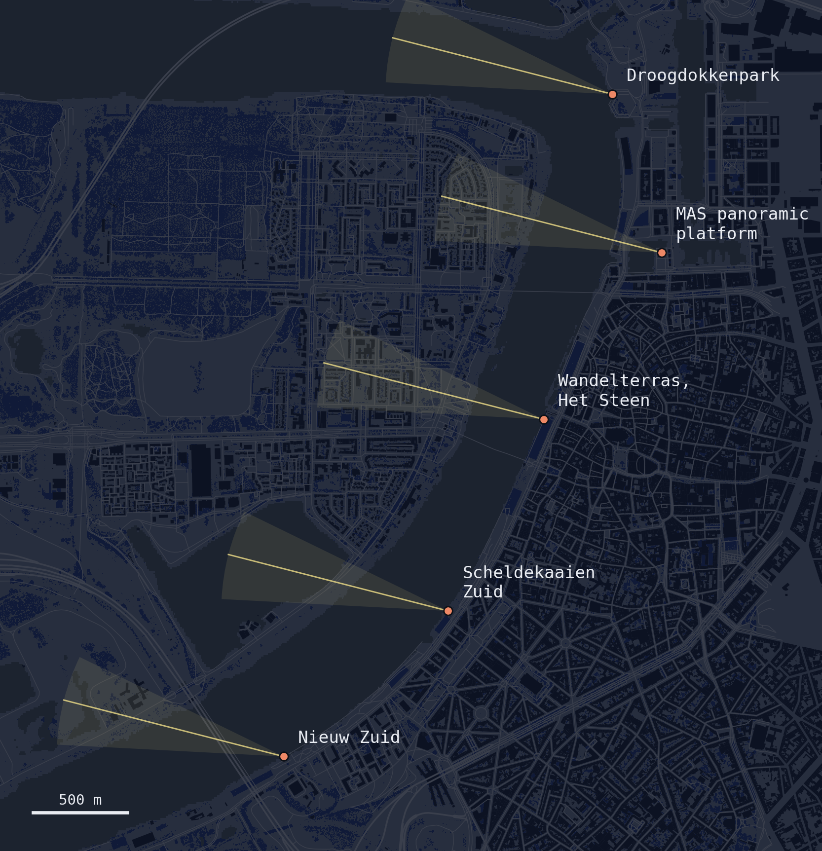
I checked the sightlines at five possible viewing spots. Any of these locations is suitable for viewing the eclipse. But are some spots better than others?
| Site TESTED | Clear viewing time | Max eclipse visible |
|---|---|---|
| MAS panoramic platformROOFTOP · 60 M HIGH | 107 min | ✓ |
| Scheldekaaien ZuidBANK · CENTRAL | 105 min | ✓ |
| Nieuw ZuidBANK · SOUTH | 103 min | ✓ |
| DroogdokkenparkBANK · NORTH | 103 min | ✓ |
| Wandelterras, Het SteenRAISED TERRACE · 5 M HIGH | 93 min | ✓ |
I compared the sun's path against reconstructed skylines at each spot. Even from the worst viewing spot I tested, near Het Steen, the exciting part of the eclipse will still be visible.
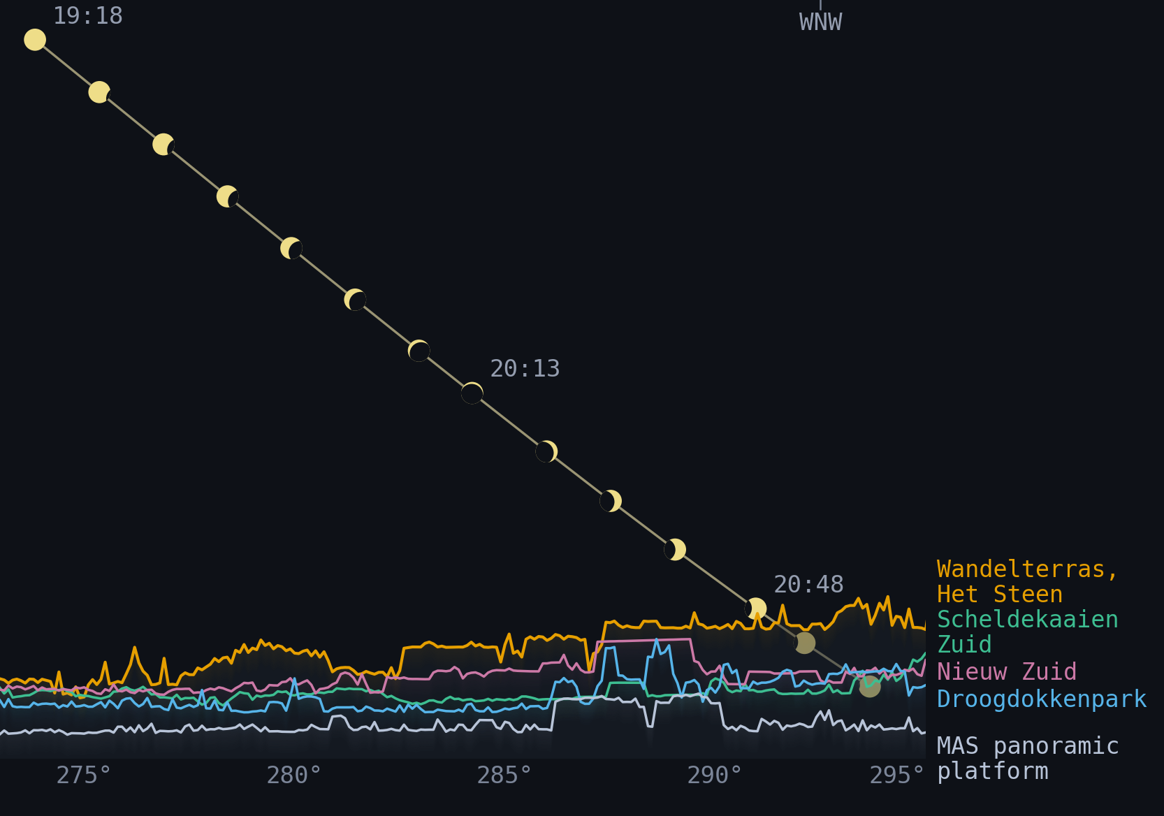
I calculated where the Sun would appear every minute during the eclipse and checked the results against NREL’s Solar Position Algorithm.
I used one-metre public lidar data to create a detailed picture of the ground, trees and structures visible from each viewing spot. New development not captured by the lidar scan was supplemented using OpenStreetMap data and ground-truth imagery.
I used building footprints and land-cover data to distinguish buildings and vegetation from water and open ground.
From each viewing spot, I traced 210 sightlines across the western horizon, reaching up to 10 kilometres. Each line records the highest obstruction, allowing for the Earth’s curvature and the slight bending of light through the atmosphere.